6 Minute Read

6 Minute Read
First of all, this post is part of a greater series of posts that I’ve written about that documents my trip to the area in the summer of 2022. If you’re looking for more on that trip and where else I went, definitely check out the post!
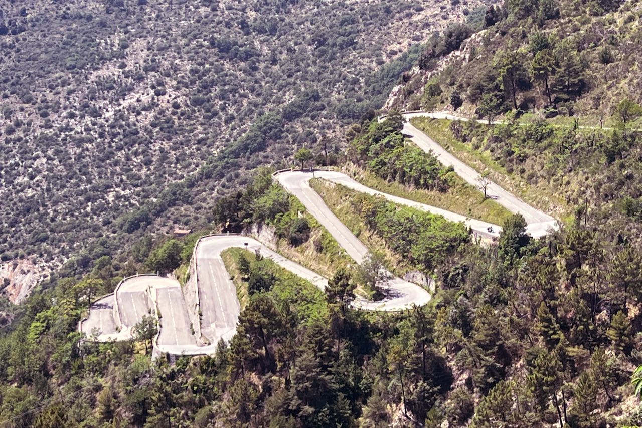
“Lacets” translates to “laces” in French. There are a lot of these tight switchbacks throughout France and some of them even look like they double back over themselves. So from above, they basically look like laces one would use to tie their shoe.
It’s a marvelous feat of engineering if you ask me.
When I was in Nice in the summer of 2022, I opted to visit and climb the Col de Braus on my second day of riding. It was actually my most ambitious day of riding, as the total distance I planned for the day was over 80 miles and over 10,000 feet of climbing!
If you check out Cafe du Cycliste's Nice Rider's Guide, you’ll see that they will often group this climb with the Col de Turini as part of a larger, epic loop, starting from their shop in Nice. Given that I was new to the region and that I was doing this solo, I opted to (mostly) follow their route.
But if you follow this blog, you’ll know that I, of course, had to add my own flair to this one.
So since I also wanted to climb the Col de Turini, I opted to climb the Col de Braus from the west via the town of L'Escarene, traveling onward into Sospel. This allowed me to take a different way to the base of the climb.
If you’re coming from the eastern side of the region, I highly recommend getting to the base of Col de Braus by first climbing up to La Turbie and then head up further into the region of Peille. According to Happily Ever Travels, this ancient, medieval town is also known as “le plus curieux” or “the most curious”.
It’s also just an incredibly beautiful valley and area. The road snakes around the edge of what I perceived as a big mountainous bowl, just beyond the initial mountain range that everyone is so used to seeing from the coastal, touristy Côte d’Azur. The road is beautifully maintained and relatively flat, there are several tunnels, and you get your first real taste of “lacets” roads before even reaching the beginning of the climb itself.
Descending from the medieval village of Peille is a joy as well, as you end up in a smaller town called La Grave de Peille right at the beginning of what kind of looks like a quarry / ravine. Be careful though, as the road is closed during certain days of the week due to construction traffic!
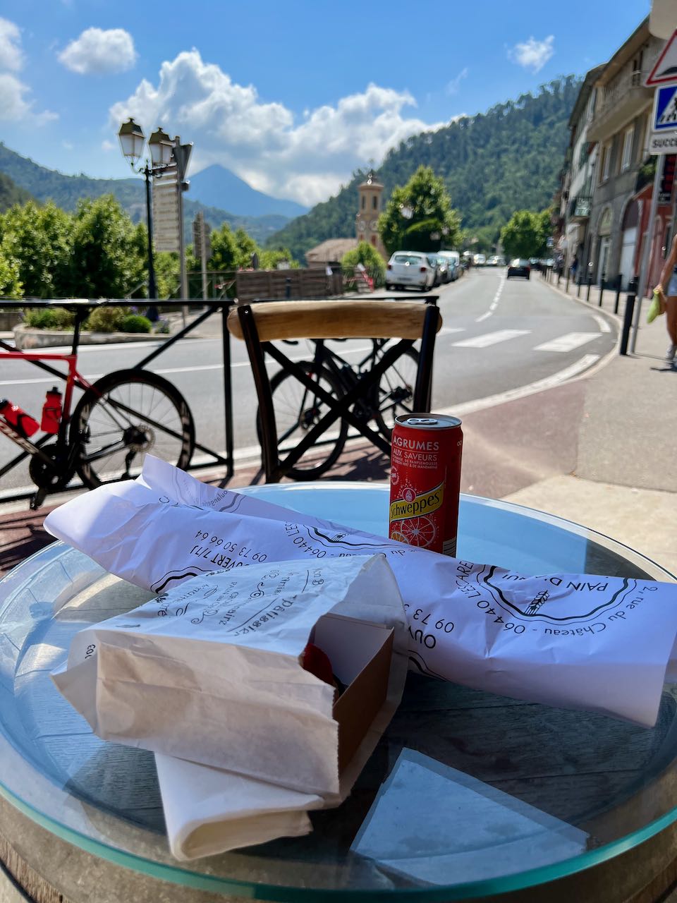
On the other side, you’re in the town of L’Escarene, where you can easily find a cafe for a quick snack and coffee before your climb. I chose to visit Pan d'Aqui, which had fresh breads and amazing baked goods.
Fun story, on the particular day that I rode up this way, I met someone from San Francisco! And as it turns out, he was riding that day with Wout Poels, who had raced in the Giro d’Italia last year! Amazing how small the world feels sometimes.
On the day that I chose to do this, it was around 32 to 35 degrees celsius, which is somewhere near 95 degrees Fahrenheit! Because of this, I remember being quite drained, as the climb from this direction is quite exposed, not leaving you much time or many places to find shade on your ascent.
It was still so much fun to climb. The views get incredible so quickly, just as it was along the coast, but instead of ocean, you’re looking at incredible greenery and hillsides, with nestled villages and other structures in between it all. This region is quite interesting from a historical perspective, too, as a lot of forts existed through here between Napoleanic times leading into the two world wars.
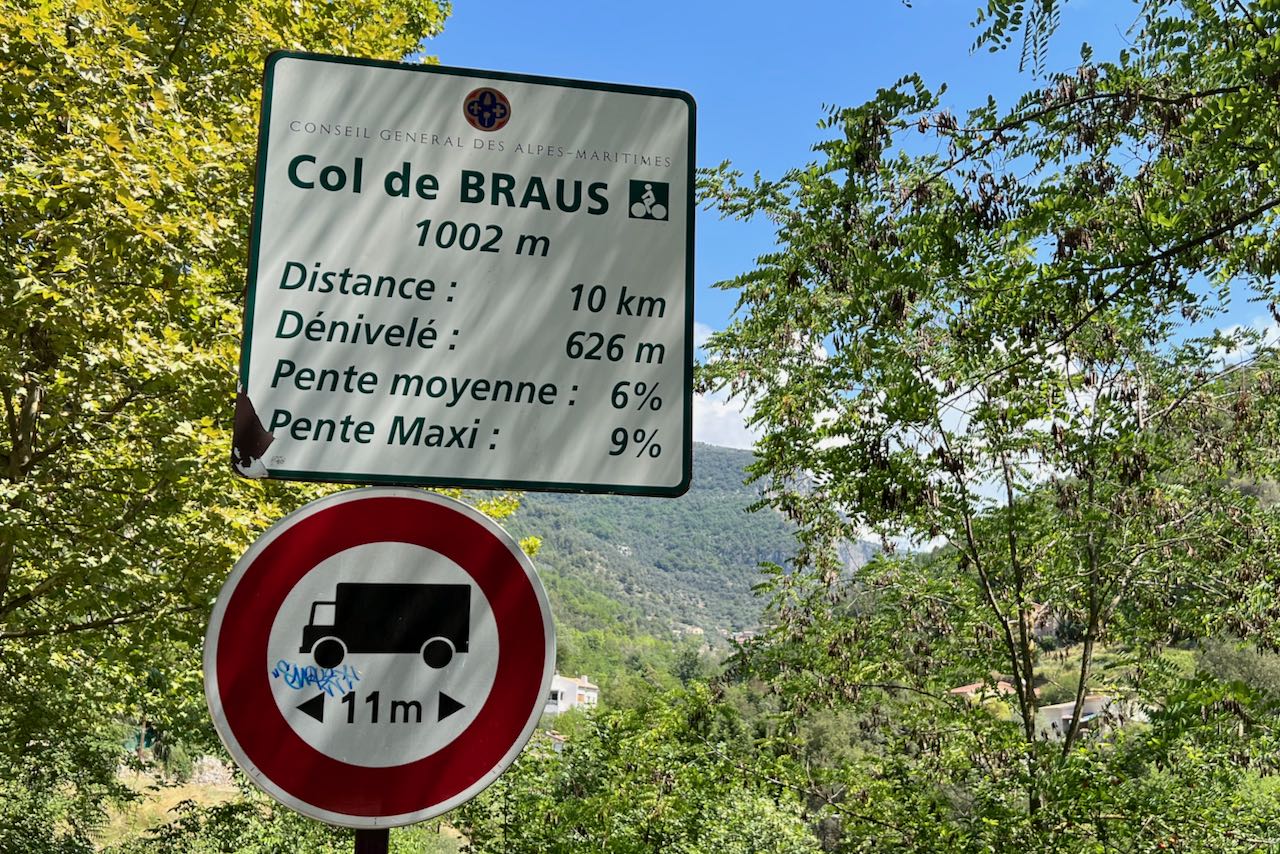
According to the Strava segment for coming up from L’Escarene, the climb is 6.2 miles / 10 km long and climbs 2064 feet / 629 meters from its starting point. The profile itself is actually quite a steady 6.3% average gradient, and there really isn’t too much out there to bother you.
It’s a wonderfully secluded climb, at least on the day I was out there. It was the first time during my trip that year where I started to really feel like I was going somewhere far away. I started near the Mediterranean Sea that morning and found myself in a drier, considerably more open and less green environment.
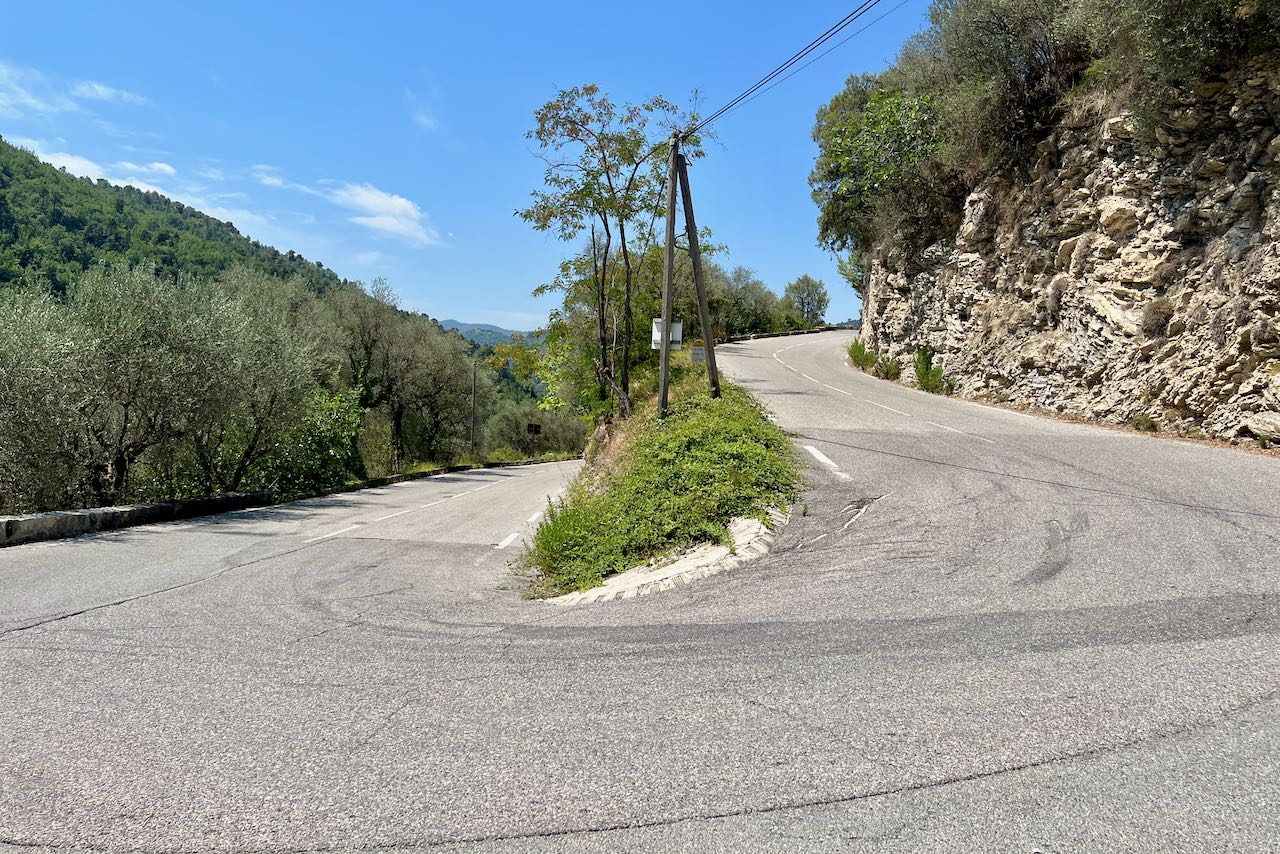
The road definitely has all of what you’d expect from an epic climb in Europe. You’re always looking up, watching the road snake its way up the mountain, completely enveloping you, almost taunting you. But you as a cyclist, rise up to meet the challenge, as it’s a climb that’s long, but not overly steep or difficult.
You climb, you suffer a bit, but you don’t pay attention to those things, as you’re just enjoying what is some of the most beautiful and iconic views as any other you’d see on TV back home. The switchbacks, or lacets, are honestly exciting to approach, as not only the road levels out slightly in their apexes, but looking out over a quiet road doubling back over itself is, in a word, mesmerizing.
The top of the climb comes almost without fanfare, as the road seems to flatten out a bit and you pass right by a small restaurant before suddenly reaching a sign or two designating the top.
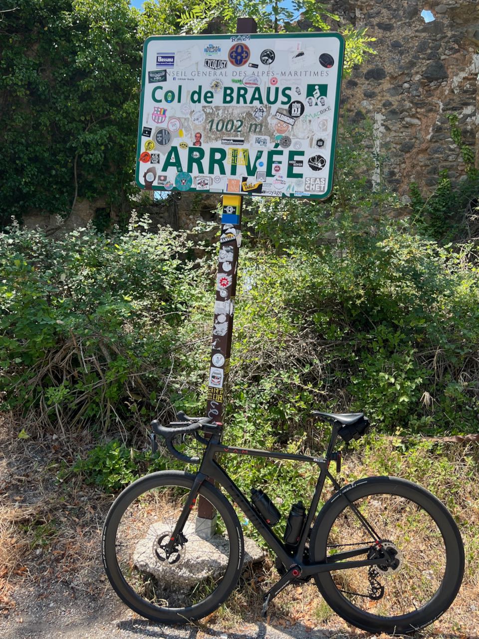
It was quiet, with a small parking lot for some cars, and an overgrown set of ruins of some kind.
Definitely take a moment to enjoy it here. It’s shaded and you’ve made it up the Col de Braus!
If you’re doing the additional route onward to the Col de Turini, you’ll end up descending down an incredible few miles of switchback heaven through here! I didn’t get nearly as many pictures here as I could have, as I was trying to pass a garbage truck of some kind, but you find yourself entering another valley, this time a bit more shaded than where you just came up from.
Take care to watch out on these roads, though. I saw some construction near the top of a set of lacets, and given how high up and how beautiful everything is, you may find yourself not fully paying attention to the road or to incoming cars, especially since there are so few of them!
Eventually you’ll find yourself in Sospel, a small town along a river with a few shops and a grocery store.
To get there, though, you do technically need to head down just a few hundred meters more, taking a hard righthand hairpin turn past a line of trees. It’s easy to follow though, as you’ll end up going that way anyway, following the road markers. It’s a great spot for a rest and refueling, as the store is easily accessible and has a section specifically for cold drinks. Oh, and they sell sunscreen, too, if you need more of it!
What a climb! On to the next one!
