16
Apr
14 Minute Read
I love working for LinkedIn. In addition to many generous perks, the company decided to give the entire company the first week off in April of 2021. They had taken some surveys, saw that the workforce was feeling a bit burned out, and actually did something about it. It’s amazing to see a company actually care this much about its workforce.
So while I had this great and amazing opportunity to have the week off to do some serious riding, my girlfriend did not have the same luxury. This meant that coordinating some kind of trip was going to be tricky if I wanted to include her, as she had other responsibilities. Luckily, she’s super supportive of me, and, while a bit bummed she couldn’t come along with, encouraged me to book some hotels and go for it.
Throughout the week, I decided to make my home base in Cambria for 3 days, then Paso Robles for 2 more, and then finally Carmel for another two. Even better, my girlfriend was able to come down and meet me Carmel for the following weekend! How awesome!

Definitely want to give a shout out to a few resources on the web I used to figure out where to ride!
My first day was perhaps the primary inspiration for me in choosing Cambria as my home base for the first few days.
I’ve been wanting to do a ride along the coast up towards Big Sur for a long while now, but have balked at it many times because the road through there is basically terrible when it comes to safety as a cyclist. However, the road is occasionally closed when the road washes out at various points along the coastline. And while I don’t want to take joy in destruction of public roads, this one gave me the opportunity to go riding along that section of road with very few annoying cars.
I rode 35 miles up, fighting headwind, and 35 miles back, enjoying a crazy tailwind, which made the return to my hotel a literal breeze. Follow the ride details in the RWGPS link above (or follow mine) and make sure to take note of Hearst Castle (a cool place to take a tour of!), Piedra Blancas lighthouse, and some of the trails listed off the side of the road such as Salmon Creek and Soda Springs trails. Oh, and don’t forget to stop in and say hello to the elephant seals on your way back, too!
Especially when there is no real traffic through here, this ride is pretty quintessential.

Longer, gradual climbs that are welcomed after battling the wind for a few miles, and beautiful cypress pines line the road as you get closer towards Ragged Point. Luckily the traffic slows once you reach Ragged Point, and there are public restrooms, an inn, and a diner / coffee shop there, too.

Beyond Ragged Point is where the really interesting part begins. The road has largely two major hills, each with their own respective downhills, the second of which even goes nearly to the ocean itself. The road winds around the edge of the mountains, giving you the feeling that you are seriously riding your bike at the end of the world.
I can’t exactly describe it any differently than that.

Remember that when you are out there, you have basically zero cell reception. And not really any services, either. So be prepared to handle your own issues, or perhaps to flag down a passer-by if help is needed. Luckily, the total distance between San Simeon, Ragged Point, and Gorda are all pretty manageable distances if you’re a regular rider. Keep all that in mind, as these kinds of thoughts can sometimes get into your head and bring in some unneeded anxiety.
The Whale Watcher’s Cafe restaurant is a nice turnaround spot, as it has snacks and food. All of it is quite expensive (I spent $22 on fish and chips), but it’s very remote and has an incredible view, so it kind of makes sense. If that doesn’t suit your fancy, there’s a small convenience store just next to it.

If you ever get a chance to do this ride when the road is mostly closed off to cars, absolutely do it. Don’t even consider anything otherwise. Go further if you can!

And say hello to the kind man at the Ragged Point Restaurant coffee bar who gave me a free drink because “I deserved it” for biking out that far. Cheers to you, good sir!
A few months back, I saw this ride mentioned in a few places within a fairly short amount of time. A buddy of mine did it and then I noticed that Phil Gaimon and Tyler Pierce (The Vegan Cyclist) did it (together) as well. I was near Cambria, and since I had just previously ridden along the coast, seeing something inland was definitely next on my list. This particular ride was also mentioned on nearly every one of my reference websites.
Stop in at Cambria Coffee Roasting Company then head out past Stolo Winery (come back for a tasting!) and Linne’s Farm Store, then enjoy some beautiful, quiet, rollers following the Santa Rosa Creek. It’s fantastic out there, and you’ll very likely see more turkeys than people!

I’ve done a lot of riding in areas where people tell me to watch out for what they each call “The Wall”. I’m usually not impressed. It may sound a bit pretentious of me, but it’s true. This, however, was indeed worthy of its warning. The Strava segment shows the road averaging over 10% for a little more than a mile and a half, with pitches that are well into 20%!

The rest of the ride is significantly less steep, luckily, and the road turns into Old Creek Road. Watch out for the backside of The Wall, too, especially if you have carbon rim brakes.
Once you get close to Whale Rock Reservoir, you follow a dry creek bed shaded by trees and nice tarmac, shown to you through filtered light beneath oak trees. It’s quite spectacular.
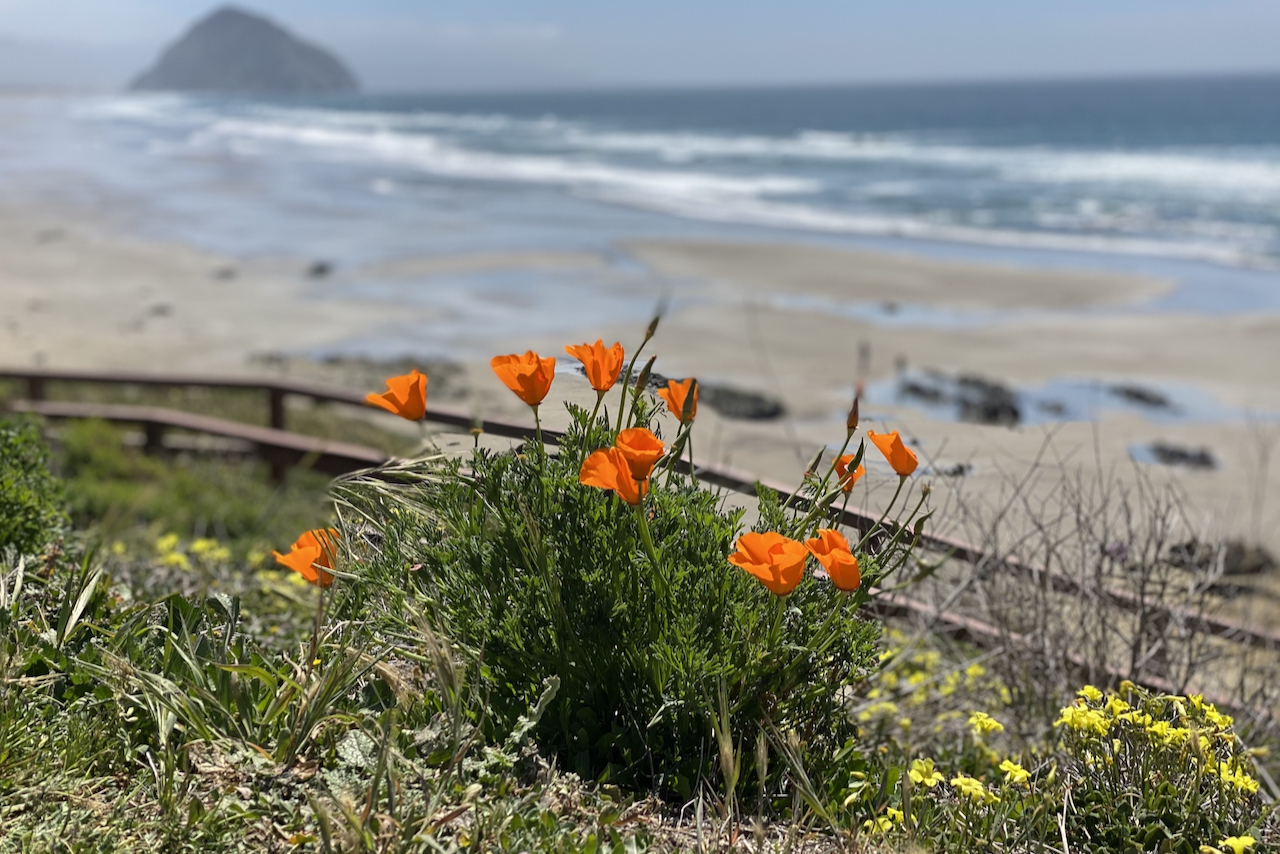
I wanted to check out Morro Bay again, as it had been a long time since I had last been there, and stopped in at Top Dog Coffee Bar after winding my way past Morro Rock.

Unfortunately, there isn’t a way through part of this where you don’t take the main Cabrillo Highway, but luckily the shoulder is pretty wide and the visibility is good. You’re also not on it too long, either.
After meandering through Morro Bay’s suburbs a bit more, I chatted with a couple on beach cruisers who were also making their way back north. I even saw them later when I stopped in at the original location for the Brown Butter Cookie Company. It’s a quiet beach town, and is worth a few minutes’ stop. There are restrooms by the pier, and it’s another pier along the California coastline that I can now say I’ve been to!

Be prepared for the journey going back to Cambria, though. While it’s beautiful and coastal, if you’re going north through here at any time in the afternoon, get ready for some serious wind. There’s a lot of gradual up and down, nothing too difficult on its own (especially as you near Harmony), but the wind really can sap the energy out of you. Just be patient, shift down and spin away, and enjoy the view.
The last hill before the Cambria city limit sign is a bit tough at the end of it all, but once you’re at the top, it’s mostly a coast downhill back to town!
After a hearty meal at Robin’s Restaurant (try the salmon bisque!), I took the next morning to recover a bit before heading out to Paso Robles, about an hour’s drive away. My ride plans for the following day included a route surprisingly close to my previous ride’s, but also touched on a few other highlights that I had heard from others. I also managed to go along some roads I drove through a few months prior on a different trip!
After a great breakfast sandwich at AMSTRDM, it was time to head out!
There are so many of them along this route! Most of the websites I was referencing recommended doing the loop starting up Adelaida and coming back down Peachy Canyon, both of which were highly regarded for their road quality. And they both did not disappoint!

I was actually impressed by how good the roads were back there, and the levels of traffic out that direction were basically nil. Only a few trucks here and there on their way to places.

I had previously been to the Justin tasting room and wanted to specifically go past it while on the bike. Definitely worthwhile! I actually got to talking to one of the women working there who seemed to be a bit of a rider herself.
“How far out are you going? Are you going to the end of the road?” she asked.
“I think so, but what exactly is the end of the road?” I replied.
Turns out that the “end of the road” was actually the entrance of a quarry of some kind, known as Lime Mountain, about 10 miles west of Justin’s tasting room. Luckily for me, I had previously found a random PDF file online that made reference to this, so I already had it loaded in my Karoo as part of my route.

While the section out from the Justin tasting room was an out-and-back (something I don’t typically like to do), it was really fun getting out there. No one but a few trucks. I got to go over one of the legs of Lake Nacimiento, and even saw literal bounding deer along the road. It was quite the experience.
If you follow my route, just be aware of what Klau Mine Road is like. It’s definitely a bit rough as you head back towards Adelaida road. Definitely manageable, for sure, but not nearly as nice as the other roads along this route are.
After making my way down through Vineyard road, where there are a ton of more ritzy wineries, I made the turn off on to Peachy Canyon road, one of the stars of the region. Smooth tarmac, few cars, and banked turns. I think I had been spoiled from some of the previous riding I had done, though, because it was basically a bit more of the same, except a bit more engaging. There was some more uphill on the “downhill” portion than I had expected though.

When I got back in to town, I found myself a bit low on water and a bit hungry. I actually debated whether I should go back to the hotel earlier than planned. I got some food and water, perked back up a bit, and proceeded to do another 20 mile loop around the east side of town.
And I’m so glad I did. I think this was my favorite part of my ride!

The roads were glassy smooth, the wind was in my favor, and I got to experience open fields of grapevines and horse ranches, sometimes as far as my eyes could see. On both sides of the road at times, even! Union Road in particular was quite a sight to behold that day.
My girlfriend and I have been wanting to do 17 Mile Drive in Carmel for a long while now. For whatever reason, it’s just never worked out for us both. Well, we made it work this time! I took off from Paso Robles the following morning and she met me in Carmel. After we got situated with the hotel, we were able to take advantage of the later light of the day and finally did the ride we’ve been wanting to do.
This was a perfect way to cap off my week. I noticed some serious fatigue starting to set in, so taking my time around Pebble Beach to look at incredible views and houses was fantastic. We got to see the so-called Ghost Tree at Pescadero Point:

And the very famous Lone Cypress Pine:

We got incredibly lucky with the weather that day. We had originally planned to ride this two days later, but had we done so, the coast would have been a bit more fogged in. The pictures certainly wouldn’t have been as good!
It’s just something that happens along the coast of California. It even happens in southern CA, too.
One of the reasons I had never been on 17 Mile Drive before was that they charge you a toll to drive through it. On the bike, however, they just wave you through! The guy at the gate even seemed very happy that we were there that day.
If you’re not on your bike and plan to visit a restaurant out in the Pebble Beach area, you can get this fee reimbursed apparently, but it’s not something I’ve had to do. Not yet at least!
We made it a point to actually veer away from part of 17 Mile Drive just after Seal Rock and ventured through Asilomar Beach and Pacific Grove. There’s a nice bike path we connected up with near Lover’s Point that let us get through a lot of traffic that’s typical of Monterey itself, especially by the aquarium and Cannery Row.

At some point, you can start heading back up towards the hills that separate Carmel from Monterey. They definitely get pitchy, and there’s even a small section along Skyline Road that had pitches in the 10% range, but do yourself a favor and find the turnoff that we took to get down to Scenic Drive. It diverts you from taking a beautiful, but busy section of the 68 highway. The Google street view doesn’t look like much, but it was paved, and was not a problem for a road bike.
On the way up, make sure to enjoy the views. If it’s sunny and in the afternoon, the filtered light through the trees is something spectacular to witness in person, and the peek-a-boo views of the ocean through the cypress trees remind you that, yet again, this area is special.
At some point, you start to head back down, the houses get bigger, and you eventually get back on to 17 Mile Drive. Have fun here on this segment! Especially if you’re a fan of descending. It was magical. Once you see the guardhouse again, you turn downward again, the road opens up, you dive through the trees, and everything just comes into view and is perfect.
This whole ride was a small slice of nirvana that truly made me feel like my week had been one of the best things I could have done for myself.
Final stats for the week stack up to 228 miles over 4 separate rides. As an avid cyclist who really enjoys getting out there, this was one of the best things I could have done for myself, given the opportunity that LinkedIn provided me. It’s nice to be appreciated for the work that we all do, and hopefully more companies can do something similar for their employees when they are able.
I’ve talked a long while about designing my own ride camp. And it seems that I’ve finally followed through on one!


