31
Dec
9 Minute Read
After two days of epic riding in Tucson, there was one route left that we had not yet done. So, of course, I got to planning the best, er, most interesting way to do it. I looked around for random things on maps, scoured through Strava’s terrible segment explorer, and came up with an interesting route. A route that I did not expect to enjoy as much as I did!
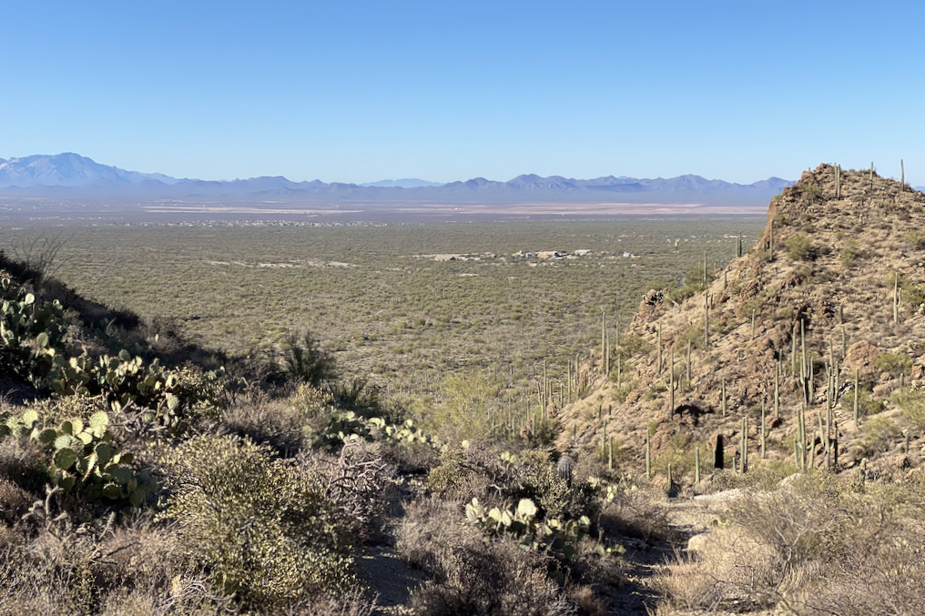
The city of Tucson splits the Saguaro National Park in two halves, meaning that there is a west and east park on either side of the city. The ride we did this day was on the east side of town, a bit south of the Tanque Verde area if you’re familiar with the area (it’s apparently where the younger families live these days from what we hear).
After paying an entry fee, even while on the bike (or using the US Park Pass), you’ll see what makes this route interesting. The full loop is just about 8 miles, according to Strava. It’s particularly known for some of the best and more mature examples of Saguaro Cactuses, as well as being home to a lot of native species like the javalina and the desert quail.
The road through the park was actually a bit more pitchy than I expected, and even went higher in elevation than I thought it would. Considering that there are a ton of YouTube videos out by people far less passionate than I am about this sport, I was a little shocked by this. But objectively, it still is quite mild, and the road even feels like a roller coaster while riding along it, partially due to the silky smooth roads throughout the park. It absolutely is a reasonable and fun ride for most skill levels.

It is crazy beautiful out there. If you’re anything like me, you’ll find yourself stopping every few hundred feet to get another photo. And don’t feel ashamed to do it! Everyone else is!
The loop is actually a one-way road, going clockwise (start out going left at the fork after the ranger station) so there is considerably less to worry about in terms of traffic. I mean, minus the cars who are also sightseeing as much as you are, so you still watch out for them of course.
The first half is actually largely uphill, but that means you’re rewarded with incredible views at the top as well as a nice descent on the other side.

At some point towards the end of the loop, the road actually becomes two-way again (there’s a picnic area you can drive out to on the southern end of the loop), so keep that mind on your way back out.
Sounds touristy, right? Well, it totally is. But it’s a great addition if you’re looking to do more than just 8 miles on the bike (or loops over those 8 miles). We had parked the car at the parking lot just outside the visitor’s center, so we gathered a few things after we rode the loop, and then proceeded onward to another interesting part of the Tucson valley.

The climb along Old Spanish Trail is super steady, not too steep, but definitely can drone on. I personally like these kinds of climbs, as I find myself pushing myself a lot harder than I normally would, possibly due to my gearing or just getting into the right headspace. It weirdly gives me calm in the midst of what is normally quite a busy place inside my brain.
There’s a fair amount of traffic along Old Spanish Trail through here, so keep that in mind. At some point, though, there’s a right turn into a bunch of new developments that all the cars seem to turn off on, so you’re left with a pretty quiet road for the remainder of the trip up to Colossal Cave.

It’s exactly what you think it is - a tourist trap for a cave with stalagmites and stalagmites (which I’m sure is cool on its own, especially for families traveling through town or looking for somewhere to escape the heat), but the ride out there is surprisingly interesting. At least it was for me. Kind of reminded me of a random ride I did a few years ago near Milwaukee, Wisconsin called Holy Hill.
After a fairly steep climb up to a parking lot, there’s a short walk out to an overlook where an entry is to the cave itself. The views from here are quite spectacular, and we found ourselves hanging out there eating snacks for a bit longer to specifically enjoy it.

Apparently my Grandpa in his earlier days was all about driving down paths he had never been before. My aunt at his funeral mentioned this and even recalled a fun story about how he got them all stuck in an old Rambler before having to literally head back on foot to get help. Her recounting this story really struck home to me because I’m basically the same way when it comes to biking!
In planning for this ride, I noticed on Google maps that the east side of Colossal Canyon road actually continued back around towards Pistol Hill road. Unfortunately though, basically every single mapping application I was using kept recommending me go back the way we came in to continue heading down and around. This wasn’t good enough for me! We decided to take the risk and head out the road less traveled (literally so), despite being only surrounded by cactuses and having no Google street view for which to base our decisions.

And rough road it was!
For the most part. Not all of it was bad though. I actually found it to be really quite spectacular. I mean, c’mon:

Both my girlfriend and I were in awe at just how picturesque this place was. It was remote, but serene. Just something that you’d expect to see out of movie where the hero rides off into the desert sunset.
There’s a gate at the end that you have to walk around, some more rough road, and eventually you’ll find yourself back at the main road. It’s all doable on a road bike, but just know that it’s something to take slowly. And hopefully with tubeless tires!
Another interesting tidbit about Tucson is that there are a ton of what they call “boneyards” for old, out of service airplanes. This includes military and civilian planes alike. Since there’s so much available cheap space out there, combined with favorable (i.e., dry) atmospheric conditions, planes that are too costly to disassemble and repurpose or scrap for parts end up being transported here.
Since it’s basically part of the outskirts of the city, and most of the roads around near there had bike lanes, we figured, why not incorporate this into our road back to the car?
To get there, we actually took a few extra roads around through Vail, a fairly empty looking suburb way outside of Tucson (with apparently great schools), and picked up another section of The Loop to head back a bit closer towards the city. Specifically, this section was called the Julian Wash trail, and it was wonderful, too, for all the same reasons as I’ve written about in a previous post, but the trail itself felt a bit more remote by comparison.

The above art installation is called “Joining Hands” and is a fun little surprise that is considered to be one of the more iconic portions of the Loop trail. Check out The Loop Art Map for more information on the various art installations along the Loop.
Seriously, in Tucson, you basically just stumble into art. It’s all over!
If you get off the trail and take Valencia, you’ll find yourself back on large roads again with considerably more traffic. There’s still a great bike lane, though, and you get to go right by the Pima Air and Space Museum.

Despite not being able to get too close, this was still fun to see. Take some time, cruise along the sidewalk (it doesn’t seem to be used too much), and check out what you can see from the road. Old bombers, fighter jets (even Russian MIGs), and helicopters, all kinds of interesting things. I know I definitely want to go back to Tucson sometime to take a longer look through this museum as an actual attendee.
Apparently you can take tours through some of these (there are more than one!), but they require a background check and some pre-reservations. However, due to COVID-19, no tours were being given. We still got to see some of them from along the road and from a distance, though.

It’s amazing how many are out there, and just how big each of them are! Find a section of dirt or gravel off from the road to get as close as you can and check them out. It’s pretty crazy, especially if you take a look at Google’s satellite photos of the area. Without the satellite overlay, you’d have no idea that you’re planning a bike ride past such an interesting place of the world.
If you’re up for it, there’s a road called Escalante Road that, while extremely straight and boring looking on the map, is quite enthralling to really push your bike up. It seems to bounce up and down like so many of the roads around Tucson do. It is just so visually interesting.
I guess that was really the phrase of the day, huh?

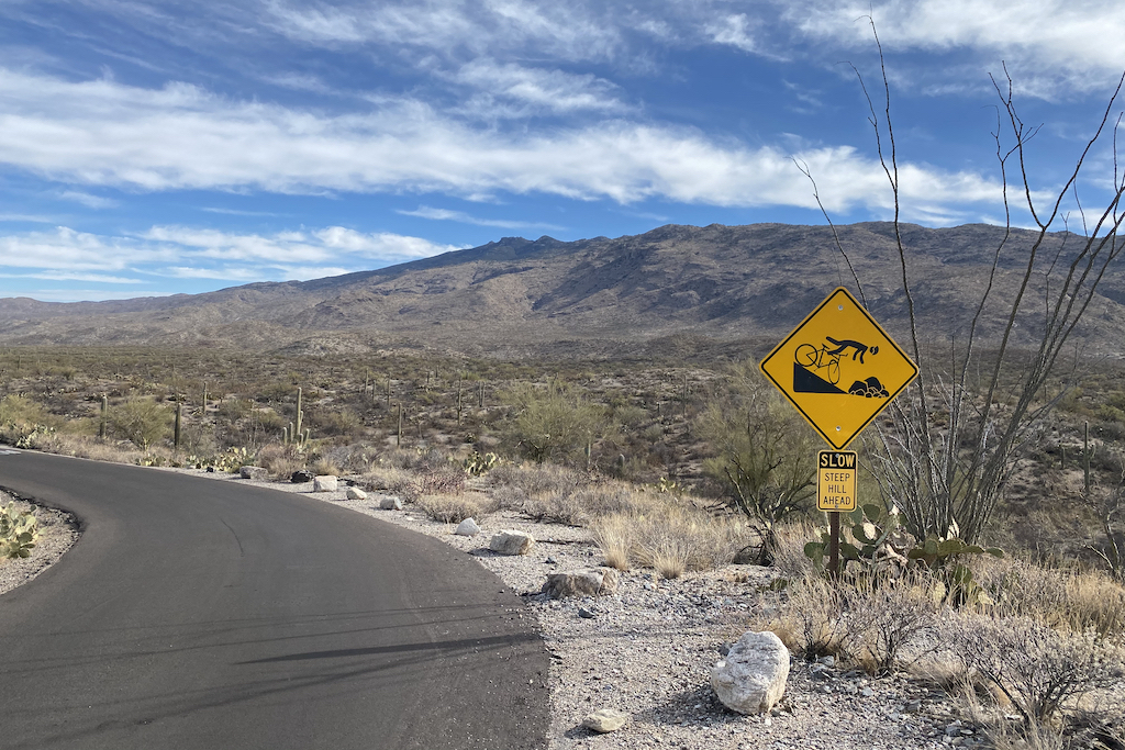
Don’t forget to grab a pic of the sign at the entrance if you haven’t already!
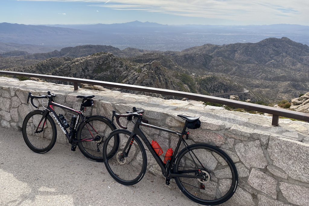
Yup, Tucson is pretty great for cycling. I’m shocked at how much was out there, from Mount Lemmon, to the west side, to what we saw on this day over on the east side. Despite not usually feeling comfortable being so isolated from civilization, I was shocked that I never felt like that at any point during this ride, so you shouldn’t either.
If you have any desire to go riding out near Tucson, I definitely recommend it. At this point, I can absolutely see why so many professional riders make their way out to Tucson each year for their winter training!